ISO Emerging Issues Perspective
By Dr. Arindam Samanta
REFINING THE VIEW OF WILDFIRE RISK AFTER THE DEVASTATING 2018 CALIFORNIA FIRES
Well-informed agents can help mitigate the risk
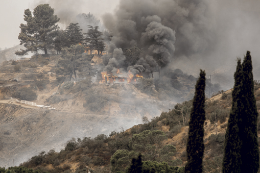
Catastrophic perils have a way of raising their own profile in the insurance industry through historic events. In 2018, wildfire continued its surge to prominence. Much as Hurricane Andrew in 1992 boosted awareness of tropical cyclone risk, the blazes that ravaged the western United States last year—adding to a string of disastrous wildfire seasons—may come to transform how we view the exposure.
Heightened awareness brings closer scrutiny of how the industry measures exposure and applies that knowledge to risk management. Assessing wildfire risk to properties is complex, and the best tools use deep, diverse, high-quality data to drive analytics and modeling that guide risk selection and exposure management.
Vigilance is needed
Ever-changing risk calls for regular updates to property-level assessments to ensure that customers have sufficient coverage—including insurance to value that reflects realistic replacement cost estimates. As the touch point between customers and their insurers, well-informed insurance advisers can be the key to guiding buyers to the right coverage and helping them navigate a marketplace significantly shaped by wildfire risk.
Wildfires have left growing scars in American communities. Over the past 10 years, an annual average of 6.9 million acres burned, trending generally upward. Multi-year totals include more than 38 million acres in the past five years and more than 18 million in the past two, according to data from the National Interagency Coordination Center. The threat is likely to continue escalating as producers seek to place risks located in sensitive areas, especially across America’s West:
- Development keeps pushing into high-risk territory known as wildland-urban interface (WUI) and intermix WUI areas.
- The surge in development comes against a backdrop of climate change, which may contribute to the growing frequency of wildfires as temperatures rise and droughts intensify.
- Data links early spring snowmelt in mountainous regions—another possible byproduct of climate change—to large wildfires. Snow cover suppresses wildfire risk, but melting exposes more dry fuel for ignition during extended dry seasons.
The exposure is not uniform. Data shows where the risk is greatest—hence, where it’s most important for agents and brokers to understand how the potential for wildfire may shape local or regional property insurance markets.
Verisk estimates show that California has by far the most properties at risk—more than 2 million—followed by Texas, Colorado, and Arizona. At the county level, leading hot spots by state are Los Angeles in California, Travis in Texas, Jefferson in Colorado, and Maricopa in Arizona.
Clients in those areas, and others at high risk, have the most urgent need to grasp key determinants of wildfire exposure, beginning with these three:
- Vegetative fuels: Grass, trees, and scrub or brush can feed a fire, so it’s important to understand their distribution around a property.
- Topography (or slope): The contours of land within and around the insured property influence the speed of wildfire.
- Access: Dead-end streets or single-access neighborhoods present special challenges for firefighters.
Other factors to consider include exposure to long-distance wind-borne embers and other types of fire-related losses—for example, smoke and ash damage, additional living expenses due to evacuations, and business interruption. Educating clients on these risks can help ensure that they have the coverage they need while encouraging them to do what they can to protect their properties.
Analysis of significant 2018 wildfires
Significant wildfires in 2018 affectedknown hot spots and more, includingArizona, Colorado, New Mexico, Oregon,and Wyoming. But California bore the greatest impact, and among many fires there in a record year, a handful stood out, demonstrating how known risk factors such as fuel and slope affect real-world experience:
- The Carr Fire burned almost 230,000 acres in Shasta and Trinity Counties; the latter has the state’s second highest concentration of properties at high or extreme wildfire risk, according to Verisk analysis. CAL FIRE reported more than 1,600 structures destroyed.
- The Mendocino Complex Fire in Northern California, two fires managed as one, burned more than 459,000 acres across Colusa, Lake, and Mendocino Counties—a state record. It destroyed 280 structures, according to CAL FIRE.
- The Camp and Woolsey Fires, in Butte and Ventura Counties, respectively, surpassed 250,000 acres, reportedly causing at least 91 deaths. More than 20,000 structures were destroyed, primarily in the Camp Fire, CAL FIRE reported.
Verisk analysis in each of these events showed at least 98% of the fire area was at risk. Except for the Camp Fire, more than 90% of the fire areas were designated high or extreme risk. But even at the lesser risk level of 70%, the Camp Fire brought tragic results to the city of Paradise.
A shared responsibility to address the threat of wildfire
Members of the ISO Community Hazard Mitigation team joined a group tour of Paradise after the Camp Fire as stakeholders from government, the fire service, the insurance industry and research organizations sought common ground against the wildfire threat. The resulting insights were eye-opening.
Ever-changing risk calls for regular updates to property-level assessments to ensure that customers have sufficient coverage—including insurance to value that reflects realistic replacement cost estimates.
A wildfire can strike at the very preparations and defenses a community depends on to protect lives and property—crippling water systems and clogging escape routes with debris. Strong winds can multiply the chaos, carrying waves of radiant heat and airborne embers.
Risk factors identified above—especially slopes and fuels—can and do accelerate wildfire growth. The Camp Fire spread nearly 15 miles downwind in 12 hours, consuming 76 acres a minute, according to local fire officials who conducted the Paradise tour. And the best local codes, while effective, are no guarantee of protection.
Continuing study can help evaluate different forms of preparation, mitigation, and response and point the way forward. Although wildfires are unpredictable, what sets the risk apart is how location-specific characteristics can help pinpoint vulnerability. This knowledge can help brokers understand property owners’ exposure to the peril and guide the coverage recommendations they present to customers.
The author
Dr. Arindam Samanta is the director of product management and innovation at Verisk.


